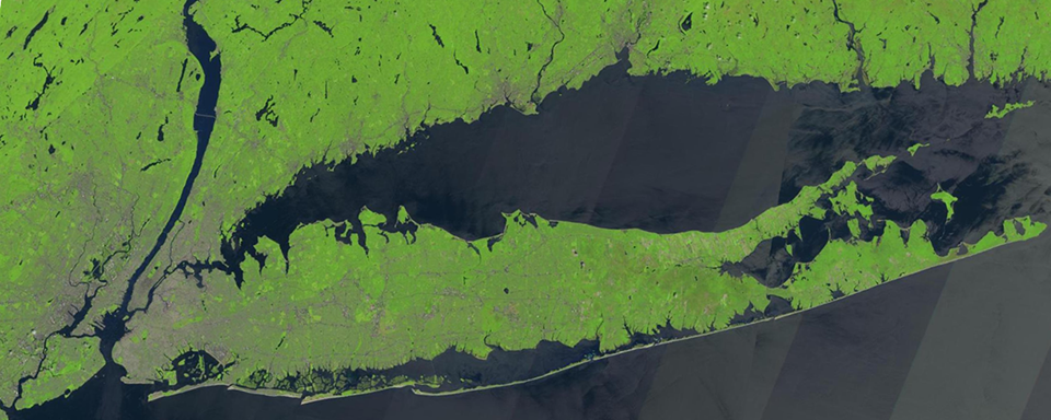
Long Island Sound Tropospheric Ozone Study (LISTOS)
LISTOS FAQ
What is LISTOS?
- The Long Island Sound Tropospheric Ozone Study (LISTOS) is a collaborative field campaign to study precursor emissions and ground-level ozone formation and transport in the New York City metropolitan region and downwind locations.
- A special emphasis of LISTOS is to gain added insight on the land-sea interactions contributing to persistently high ozone concentrations along the Connecticut shoreline of Long Island Sound.
- LISTOS also provides an opportunity for testing satellite instrumentation and analysis approaches prior to launching the Tropospheric Emissions: Monitoring of Pollution (TEMPO) satellite.
- The campaign involves a fifty-plus scientists and engineers from federal and state agencies and academia employing airborne and ground-based measurement techniques, as well as computer forecast models.
- Initial measurements from aircraft flights occurred in May 2017 and March 2018, and an expanded data collection and analysis effort is currently underway that will extend through 2019.
What are some key LISTOS research objectives?
- Assess how well emission inventories of nitrogen oxides (NOx) and volatile organic compounds (VOCs) used in air quality regulatory modeling reflect ground-based and aircraft observations, both quantitatively and temporally, especially during high ozone episodes.
- Gain a clearer understanding of wind flow patterns across NYC, Long Island, the Sound, and coastal Connecticut that transport and disperse air pollution through the region.
- Retrospectively "look back" at the impacts of historical air pollution control programs and shifts in electricity generation patterns to inform future air quality and energy policy in the region.
- Better understand the specific features of ground-level and boundary layer ozone photochemical formation and transport downwind of New York City over Long Island Sound that are responsible for on-going violations of national ozone air quality health standards.
- Develop a new case study of air pollution in a large urban area and downwind region (New York City/Long Island Sound) that complements studies elsewhere in the U.S. (e.g., Denver/Front Range, Chicago-Milwaukee/Lake Michigan, Houston-Galveston/Gulf of Mexico, Baltimore-DC/Chesapeake Bay) and can further support validation of current and future satellite measurements, as well as air quality models.
What were the 2018 LISTOS activities?
- Instrumented research aircraft from the University of Maryland College Park directly measuring air pollutants over and around Long Island Sound, with vertical profiles where possible.
- Airborne mapping measurements of trace gases (e.g., nitrogen dioxide, formaldehyde) by NASA aircraft using remote sensing methods.
- Ground-based column measurements of ozone, nitrogen dioxide, and potentially formaldehyde by U.S. EPA Pandora spectrometers.
- Ozonesonde launches by the University at Albany Atmospheric Sciences Research Center (ASRC) and NASA for obtaining vertical ozone profiles.
- Light Detection and Ranging (LIDAR) remote sensing of aerosols in New York City by the City College of New York (CCNY).
- Ozone LIDAR measurements by NASA at Rutgers, NJ and Westport, CT.
- Mobile van monitoring of ozone, nitrogen dioxide, volatile organic compounds, and other air pollutants in and around New York City, Long Island, and coastal Connecticut (NOAA-Boulder and University at Albany ASRC).
- High Resolution Proton Transfer Time-of-Flight Mass Spectrometry of VOCs at Flax Pond, Long Island by Stony Brook University.
- Aircraft wind field mapping over Long Island Sound and shorelines by Stony Brook University.
- Boat-based air quality measurements in Long Island Sound during high ozone episodes by CCNY.
- Daily marine layer ozone measurements on ferries traversing Long Island Sound (Connecticut Department of Energy and Environmental Protection).
- Gas- and particle-phase speciated organics and other air pollutant measurements at the Yale Coastal Field Station on Connecticut's Long Island Sound shoreline (Yale University).
What institutions are involved in LISTOS?
- Researcher institutions: NASA, NOAA, U.S. EPA, City College of New York, Stony Brook University, University at Albany, University of Maryland College Park, Yale University.
- Air quality management agencies: Connecticut Department of Energy and Environmental Protection, Maine Department of Environmental Protection, New Jersey Department of Environmental Protection, New York State Department of Environmental Conservation, Northeast States for Coordinated Air Use Management.
Where can I obtain LISTOS data?
- After undergoing QA/QC, LISTOS researchers will be posting publicly available data sets on the LISTOS data archive site maintained by NASA: https://www-air.larc.nasa.gov/missions/listos/index.html.
Who is funding LISTOS?
- Connecticut Department of Energy and Environmental Protection
- National Fish and Wildlife Foundation
- New Jersey Department of Environmental Protection
- New York State Department of Environmental Conservation
- New York State Energy Research and Development Authority
In addition to the above funding sources, the following institutions are providing in-the-field contributions and laboratory analysis:
- Connecticut Department of Energy and Environmental Protection
- Maine Department of Environmental Protection
- NASA
- NOAA
- New York State Department of Environmental Conservation
- U.S. EPA
Where can I learn more?
- LISTOS website: http://www.nescaum.org/documents/listos
- Draft White Paper Retrospective and Future Analysis of Air Quality In and Downwind of New York City (December 15, 2017)
- U.S EPA LISTOS Fact Sheet
- NASA
Who can I contact for more information?
- For questions on the overall effort:
Dr. Paul J. Miller
Northeast States for Coordinated Air Use Management
89 South St., Suite 602
Boston, MA 02111
pmiller [at] nescaum.org
617-259-2016
